Dunhuang Map
Map of Downtown Dunhuang
Located in the northwest of Gansu Province, Dunhuang is an important stop along the ancient Silk Road. It adjoins Xinjiang on the west and Qinghai on the south. Dunhuang is renowned for the Mogao Caves, situated 25 kilometers southeast of the downtown. Dunhuang City is small. It's very easy to get around it by city bus or taxi. On most occasions, CNY5 is enough to get to any place by taxi in the city proper.
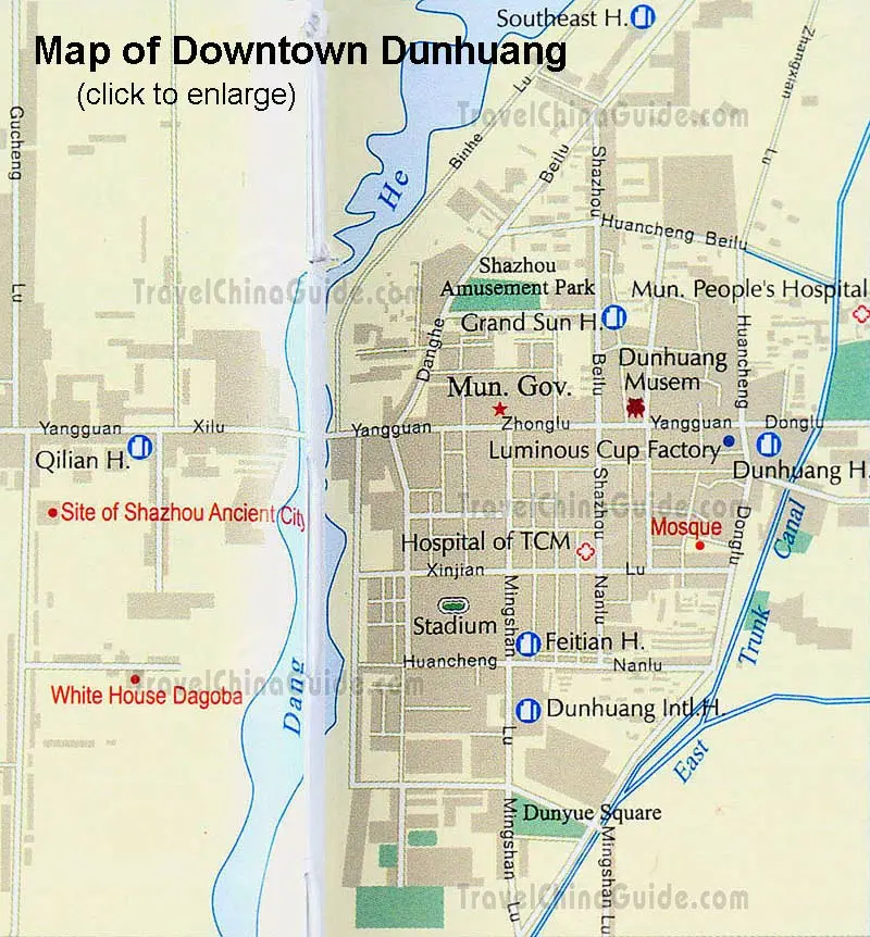
The Gansu Dunhuang map here clearly shows you the layout of the downtown Dunhuang. You can see the major roads, such as Huancheng Beilu, Huancheng Nanlu and Danghe Beilu ('lu' is the Chinese pinyin for 'road'; 'nan' for 'south'; 'bei' for 'north'). The river Danghe flows through the city, which is a very eye-catching attraction in the downtown. In this map of Dunhuang, the letter H is the abbreviation of Hotel. Dunhuang International Hotel, Feitian Hotel, Grand Sun Hotel, Qilian Hotel and Southeast Hotel can be seen. The Municipal People's Hospital and the Hospital of TCM are marked with a red cross.
The Gansu Dunhuang map here clearly shows you the layout of the downtown Dunhuang. You can see the major roads, such as Huancheng Beilu, Huancheng Nanlu and Danghe Beilu ('lu' is the Chinese pinyin for 'road'; 'nan' for 'south'; 'bei' for 'north'). The river Danghe flows through the city, which is a very eye-catching attraction in the downtown. In this map of Dunhuang, the letter H is the abbreviation of Hotel. Dunhuang International Hotel, Feitian Hotel, Grand Sun Hotel, Qilian Hotel and Southeast Hotel can be seen. The Municipal People's Hospital and the Hospital of TCM are marked with a red cross.
- Last updated on Jul. 10, 2019 -