Dalian Map
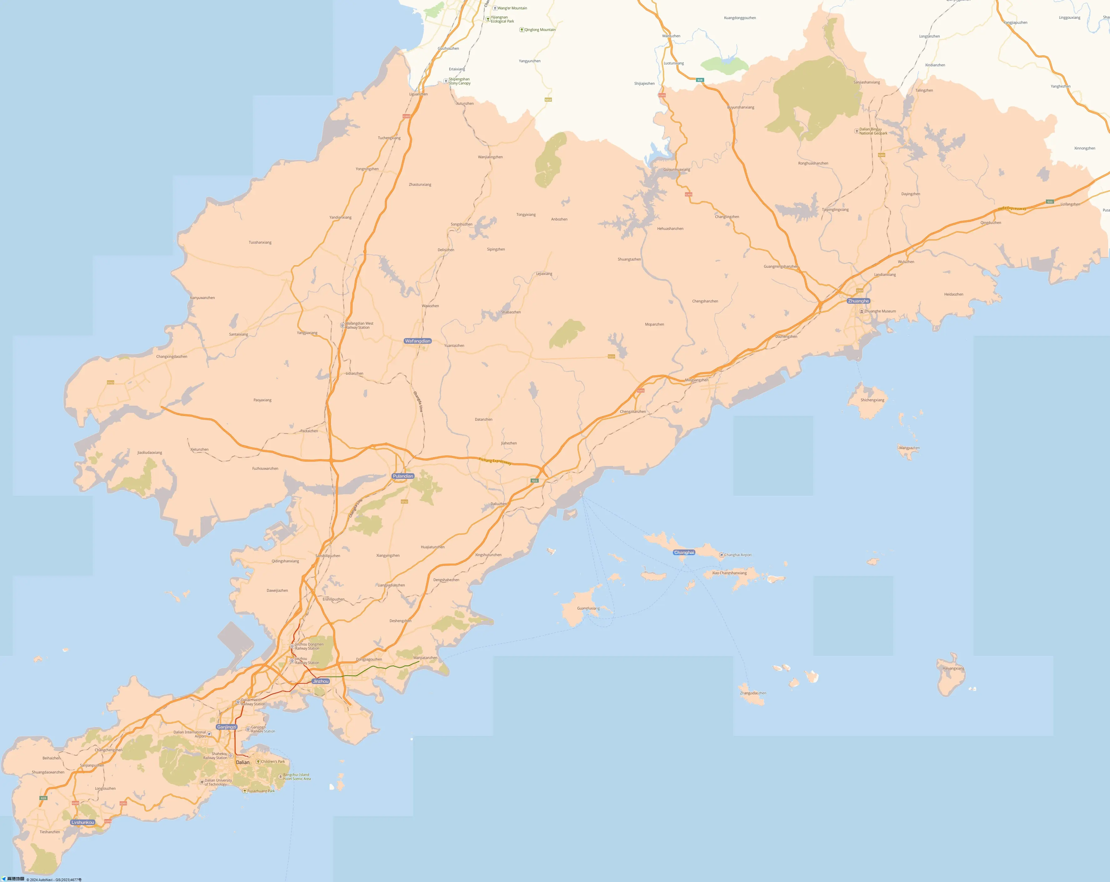
Here is the map of Dalian City, which is located on the southern end of the Liaoning Province in Northeast China. It looks on the Yellow Sea on the east, borders on the Bohai Sea on the west, lies off the northern coast of the Shandong Peninsula and leans against the three provinces (Liaoning, Jilin and Heilongjiang) in the Northeast and East Inner Mongolia. As one of China's ten most suitable cities for people to live, Dalian boasts beautiful seaside scenery and high percentage of greenery coverage.
In this map, the green zones are the highlights for sightseeing. Eight hills can be found, namely Xijian Shan, Tai Shan, Dading Shan, Baiyun Shan, Jie Shan, Nan Shan, Jing Shan and Dong Shan. Near the sea, you can find many hotels. Among those, the Xiuyue Hotel and the Bangchui Island Hotel are the nearest to the sea. Along the railways, there are six railway stations. Dalian East, Dalian West, Dalian North and Dalian railway stations are not far from each other. Almost all the trains to/from Dalian pass the Dalian Station. Leaving Dalian for other cities, you may go there to take a train.